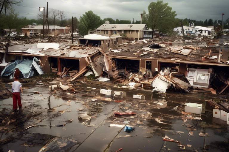
Planning Evacuation Routes - A Necessity in Disaster Preparedness
In a world where natural disasters can strike without warning, the need for effective planning cannot be overstated. Planning evacuation routes is not just an afterthought; it is a fundamental aspect of disaster preparedness. Imagine waking up to the sound of sirens blaring, the ground shaking, or smoke filling the air. In those moments, having a clear, well-thought-out evacuation plan can mean the difference between safety and chaos. With the right strategies in place, communities can ensure that residents know exactly where to go and how to get there during an emergency.
Evacuation routes serve as lifelines, guiding individuals to safety while minimizing confusion and panic. When a disaster occurs, time is of the essence. The faster people can evacuate, the higher their chances of survival. However, this is only possible with proper planning and preparation. It involves understanding the unique challenges posed by different types of disasters, whether they be hurricanes, wildfires, or floods. Each scenario requires a tailored approach to ensure that evacuation routes are not only effective but also safe.
Moreover, the significance of these routes extends beyond individual safety; they are essential for the overall resilience of a community. When evacuation routes are well-planned, they allow for the efficient movement of emergency services, ensuring that help can reach those in need without unnecessary delays. This coordination is crucial during disasters, where every second counts. In essence, planning evacuation routes is about creating a safety net that protects lives and enhances community resilience.
In the following sections, we will delve into the key factors that influence evacuation route planning. From understanding population density to assessing geographical features, each element plays a pivotal role in ensuring that evacuation routes are effective and reliable. So, let's explore how we can better prepare ourselves and our communities for the unexpected.

Understanding the Importance of Evacuation Routes
When disaster strikes, the chaos that ensues can be overwhelming. This is where evacuation routes come into play, serving as lifelines that guide individuals to safety. Think of these routes as the fast lanes to safety during an emergency, ensuring that people can escape danger swiftly and efficiently. Without well-planned evacuation routes, the risk of confusion and panic increases exponentially, which can lead to disastrous outcomes. Imagine a bustling city facing a natural disaster, where everyone is trying to leave at once without clear directions—chaos would reign supreme. Therefore, having a clear and effective evacuation plan is not just a good idea; it's a necessity.
The importance of evacuation routes extends beyond mere logistics; they play a vital role in enhancing survival rates during emergencies. In fact, studies show that communities with established evacuation plans experience significantly lower casualties during disasters. This is largely due to the fact that people know where to go and how to get there, reducing the likelihood of congestion and ensuring a smoother evacuation process. Moreover, well-defined routes allow emergency services to operate effectively, providing assistance where it's needed most. When planning these routes, various factors must be considered, including the population density, the geographical landscape, and the availability of infrastructure.
One of the key considerations in evacuation route planning is understanding how many people live in a given area. High-density populations can lead to bottlenecks if multiple individuals try to use the same route simultaneously. Therefore, it's essential to identify potential high-risk zones—areas that are more likely to be affected by disasters—and plan multiple evacuation routes to accommodate the influx of evacuees. This proactive approach can significantly reduce the chances of overcrowding and ensure that everyone has a clear path to safety.
Additionally, the geographical features of an area can greatly influence the effectiveness of evacuation routes. For instance, rivers, mountains, and urban layouts can create natural barriers that complicate escape efforts. Understanding these geographical elements is crucial for creating safe and effective routes. Emergency services accessibility must also be taken into account; evacuation routes should be designed to allow for quick access by emergency responders to provide timely assistance and aid.
In summary, the importance of evacuation routes cannot be overstated. They are essential for ensuring a timely and safe relocation of individuals during emergencies, helping to minimize chaos and increase survival chances. By understanding the factors that influence route planning, communities can create effective strategies that not only protect lives but also foster a sense of security among residents. After all, when people know they have a plan in place, they can face disasters with confidence rather than fear.

Key Factors in Route Planning
When it comes to planning evacuation routes, there are several key factors that must be considered to ensure that the process is efficient and effective. These factors include population density, geographical features, and available infrastructure. Each of these elements plays a crucial role in determining the feasibility and safety of the escape routes during a disaster.
First and foremost, understanding population density is essential. In areas where people are densely packed, the risk of congestion during an evacuation increases significantly. Imagine trying to exit a crowded concert venue; the more people there are, the slower the movement becomes. This analogy holds true in emergency situations as well. By assessing population density, planners can identify high-risk areas that may require multiple evacuation routes to prevent overcrowding. It’s vital to have alternative paths to ensure that everyone can evacuate in a timely manner.
To effectively plan evacuation routes, it is important to assess the population density of the region. This assessment helps in identifying high-risk zones that may require special attention. For instance, urban areas with tall buildings and narrow streets may face challenges during an evacuation. By identifying these high-risk zones, authorities can prioritize evacuation efforts and develop strategies that minimize risk for the affected populations.
High-risk zones are often prone to disasters such as floods, wildfires, or earthquakes. By pinpointing these areas, emergency planners can focus their resources and strategies on ensuring the safety of residents. For example, if a certain neighborhood is known for frequent flooding, planners can create designated evacuation routes that steer residents away from those flood-prone areas, thereby reducing the likelihood of chaos and confusion during an emergency.
Another critical factor in route planning is the accessibility of evacuation routes for emergency services. It’s not just about getting people out; it’s also about ensuring that help can get in. If roads are blocked or unsuitable for emergency vehicles, it can hinder timely assistance. Therefore, planners must consider the layout of roads and the infrastructure in place. This includes ensuring that routes are wide enough and free from obstructions, allowing emergency responders to reach those in need quickly.
Geographical features such as rivers, mountains, and urban layouts can significantly impact the planning of evacuation routes. For instance, a river may act as a natural barrier, necessitating the identification of bridges or alternative routes. Similarly, mountainous terrain can complicate evacuation efforts, making it essential to create routes that are not only safe but also accessible. Understanding these geographical elements is crucial for creating effective evacuation strategies that can withstand the challenges posed by the environment.
Ultimately, the effectiveness of evacuation routes hinges on a comprehensive understanding of these key factors. By paying careful attention to population density, high-risk zones, emergency services accessibility, and geographical considerations, planners can create robust evacuation strategies that prioritize safety and efficiency. The goal is not just to evacuate but to do so in a way that minimizes panic and maximizes the chances of survival.
- What should I do if I live in a high-risk zone?
If you live in a high-risk zone, it’s essential to stay informed about local emergency plans and evacuation routes. Consider creating a personal evacuation plan with your family and participating in community drills.
- How often should evacuation routes be reviewed?
Evacuation routes should be reviewed and updated regularly, especially after significant changes in population density or infrastructure. Annual assessments are recommended.
- Can I prepare my own evacuation kit?
Absolutely! Having an evacuation kit ready can make a significant difference in an emergency. Include essentials like water, food, medications, and important documents.

Assessing Population Density
When it comes to evacuation route planning, assessing population density is like holding a magnifying glass over the areas that are most vulnerable during emergencies. Understanding how many people live in a given area helps identify high-risk zones that may require multiple evacuation routes. Imagine a bustling city where thousands of residents live in close quarters. If disaster strikes, such as a fire or flood, the last thing you want is a bottleneck of people trying to escape through a single exit. This scenario can lead to chaos, panic, and, unfortunately, a higher risk of casualties.
By analyzing population density, emergency planners can pinpoint where the most significant challenges will arise. For instance, high-density neighborhoods might need specific routes that can accommodate larger groups of people moving simultaneously. It's not just about getting people out; it's about doing so in a way that minimizes confusion and maximizes safety. In this context, planners often utilize data from census reports and local surveys to create a comprehensive map of population distribution.
Moreover, the characteristics of the population must also be considered. Are there many elderly residents or individuals with disabilities who may require additional assistance? Understanding these nuances can help in designing routes that cater to everyone's needs. For example, routes that are easily navigable for those with mobility challenges should be prioritized. This approach ensures that evacuation plans are inclusive and effective.
In addition to identifying high-density areas, planners should also consider the time it takes for individuals to evacuate. This is where traffic simulations come into play. By modeling how people will move through designated routes, planners can anticipate potential delays and make adjustments accordingly. If a route is expected to be congested, alternative paths can be established to disperse the crowd more effectively.
Ultimately, a thorough assessment of population density is crucial for developing a robust evacuation strategy. It not only highlights the areas that are most at risk but also informs the design of routes that can accommodate the unique needs of the community. By prioritizing these considerations, we can significantly enhance the safety and efficiency of evacuation efforts, ensuring that when disaster strikes, people can escape swiftly and safely.
- Why is population density important in evacuation planning? Understanding population density helps identify high-risk areas that may require multiple evacuation routes to prevent overcrowding and ensure efficient movement during an emergency.
- How do planners assess population density? Planners use data from census reports and local surveys to create comprehensive maps of population distribution, allowing them to identify high-density neighborhoods and their specific needs.
- What role do traffic simulations play in evacuation planning? Traffic simulations help planners anticipate potential delays in evacuation routes, allowing them to adjust plans and establish alternative paths to ensure a smooth evacuation process.

Identifying High-Risk Zones
When it comes to disaster preparedness, one of the most crucial steps is . These are areas that are particularly vulnerable to natural disasters such as floods, earthquakes, hurricanes, or wildfires. By pinpointing these zones, communities can prioritize their evacuation planning efforts and allocate resources effectively. Think of it like a game of chess—you need to know where the threats are to protect your king, or in this case, your community.
High-risk zones can vary significantly based on geographical location and historical data. For instance, coastal areas are often at risk for hurricanes, while regions near fault lines face the threat of earthquakes. To identify these zones, local authorities typically analyze a combination of factors, including:
- Historical Data: Reviewing past incidents can provide valuable insights into which areas are most prone to disasters.
- Geographical Features: Natural landscapes such as rivers, mountains, and valleys can influence the likelihood of certain types of disasters.
- Population Density: Areas with higher populations may require more urgent evacuation plans since they can become congested quickly during an emergency.
Once high-risk zones are identified, it’s essential to create a comprehensive map that outlines these areas. This map should be easily accessible to the public, ensuring that everyone knows whether they live in or near a high-risk zone. Additionally, local governments should consider implementing a system to regularly update this information as new data becomes available. Just like the weather, disaster risks can change, and staying informed is key to safety.
Moreover, community involvement plays a significant role in this identification process. Engaging residents in discussions about their experiences and observations can uncover insights that data alone might miss. For example, someone who has lived in an area for decades may have noticed patterns or risks that are not immediately apparent to researchers. By fostering a culture of awareness and preparedness, communities can better equip themselves to handle potential disasters.
In summary, identifying high-risk zones is a fundamental aspect of disaster preparedness. It not only helps in planning effective evacuation routes but also in ensuring that resources are allocated where they are needed the most. With a proactive approach, communities can significantly enhance their resilience against the unpredictable nature of disasters.
- What should I do if I live in a high-risk zone? It's essential to stay informed about local emergency plans and participate in community drills.
- How often should evacuation routes be reviewed? Evacuation routes should be reviewed annually or after any significant disaster event.
- Can I help identify high-risk zones in my community? Yes! Engaging with local authorities and sharing your observations can contribute to better planning.

Emergency Services Accessibility
When the clock is ticking and chaos is unfolding, the accessibility of emergency services becomes a lifeline for those in distress. Think about it: if an evacuation route is jammed with vehicles or blocked by debris, how can emergency responders reach those who need help the most? This highlights the critical need for planning evacuation routes that not only facilitate the movement of the general public but also ensure that emergency services can navigate through with ease. A well-planned evacuation route should consider the locations of fire stations, hospitals, and police departments, ensuring that these essential services can respond swiftly to emergencies.
Moreover, it’s crucial to incorporate multiple access points along evacuation routes. This can significantly enhance the flow of traffic in and out of high-risk areas. Imagine a scenario where a natural disaster strikes, and everyone is trying to escape through the same narrow road. The result? Gridlock, panic, and a potential tragedy. Instead, by creating alternative routes and ensuring they are clearly marked, we can alleviate pressure on primary evacuation paths and allow emergency services to reach those in need without delay.
Additionally, regular assessments of these routes are vital. Geographical changes, urban development, or even seasonal weather conditions can alter the landscape, impacting accessibility. By conducting routine evaluations, communities can identify potential hazards or bottlenecks that could impede emergency services. Here’s a quick overview of factors to consider when assessing emergency services accessibility:
| Factor | Considerations |
|---|---|
| Route Width | Is the road wide enough for emergency vehicles to pass through safely? |
| Clear Signage | Are there clear signs directing both evacuees and emergency personnel? |
| Maintenance | Are the routes regularly maintained to prevent blockages? |
| Traffic Management | Is there a plan in place for managing traffic flow during an evacuation? |
In conclusion, ensuring emergency services accessibility is not just a matter of convenience; it’s a matter of life and death. By prioritizing this aspect in evacuation planning, communities can create a robust safety net that protects lives during disasters. When everyone knows the routes, understands their purpose, and sees that emergency services can reach them, it fosters a sense of security and preparedness that can make all the difference in a crisis.
- Why is planning evacuation routes important? Planning evacuation routes is essential for ensuring the safety and timely relocation of individuals during emergencies, reducing chaos and increasing survival chances.
- What factors should be considered in evacuation route planning? Key factors include population density, geographical features, available infrastructure, and accessibility for emergency services.
- How can communities improve evacuation route effectiveness? Regular drills, community involvement, clear signage, and routine assessments of routes can significantly enhance evacuation effectiveness.
- What role do emergency services play in evacuation planning? Emergency services must have accessible routes to respond quickly during disasters, making their accessibility a crucial element of effective evacuation planning.

Geographical Considerations
When planning evacuation routes, play a pivotal role in ensuring safety and efficiency. The natural landscape can either facilitate or hinder the evacuation process, making it essential to thoroughly analyze various geographical features. For instance, rivers and mountains can pose significant challenges. Imagine trying to evacuate a city surrounded by steep hills; the routes must be carefully chosen to avoid bottlenecks that could trap individuals in hazardous situations. In contrast, flat terrains might allow for multiple escape routes, but they can also lead to overcrowding if not properly managed.
Additionally, urban layouts can greatly influence evacuation strategies. A city with a grid-like structure may offer more straightforward navigation, while one with winding streets can create confusion during a crisis. To illustrate this point, consider a hypothetical city with two distinct neighborhoods:
| Neighborhood | Evacuation Route Complexity | Potential Challenges |
|---|---|---|
| Grid City | Simple, direct routes | Risk of overcrowding |
| Winding Streets | Complex, confusing routes | Higher chance of getting lost |
Furthermore, the presence of infrastructure such as bridges, tunnels, and highways must be taken into account. These elements can serve as lifelines during evacuations, but they also need to be assessed for their ability to handle large volumes of traffic. For example, a single bridge may become a choke point, leading to gridlock and delaying escape. Therefore, planners should identify alternative routes that can accommodate the expected flow of evacuees.
Another critical aspect is the weather conditions that may affect the geographical landscape. Flooding can render certain routes impassable, while snow or ice can create treacherous driving conditions. By monitoring weather patterns and historical data, planners can make informed decisions about which routes to prioritize or avoid altogether during an evacuation.
In summary, geographical considerations are not merely an afterthought in evacuation planning; they are a fundamental component that can determine the success or failure of an emergency response. By understanding the unique characteristics of the landscape, planners can devise routes that not only facilitate quick evacuations but also enhance overall safety for the community.
Q1: Why are geographical considerations crucial for evacuation routes?
A1: They help identify potential obstacles and challenges that could hinder safe and efficient evacuations, ensuring that routes are practical and effective.
Q2: How can weather impact evacuation planning?
A2: Weather conditions can affect road accessibility and safety, making it essential to consider historical weather data when planning evacuation routes.
Q3: What role does community involvement play in evacuation planning?
A3: Engaging the community fosters awareness and preparedness, empowering individuals to understand and utilize evacuation routes effectively during emergencies.

Best Practices for Evacuation Planning
When it comes to evacuation planning, adopting the right practices can make a world of difference in ensuring safety during emergencies. Imagine being in a chaotic situation where every second counts; having a well-thought-out plan can transform a potentially disastrous scenario into a manageable one. One of the most effective strategies is to conduct regular evacuation drills. These drills not only familiarize individuals with the escape routes but also instill a sense of confidence and preparedness. Think of it like practicing for a big game; the more you rehearse, the better you perform under pressure.
Another crucial aspect is community involvement. Engaging local residents in the planning process fosters a sense of ownership and awareness. When people feel that they are part of the solution, they are more likely to take proactive steps to ensure their safety and that of their neighbors. This could involve organizing community meetings, sharing information through local social media groups, or even setting up a neighborhood watch for emergencies. The goal is to create a network of informed individuals who can support one another in times of crisis.
Effective communication is also paramount in evacuation planning. Clear communication strategies should be established well in advance. This includes creating evacuation maps that are easy to understand and disseminating them throughout the community. Consider using multiple channels to reach different demographics, such as flyers, social media, and community boards. The more accessible the information, the better prepared everyone will be. Furthermore, using technology to your advantage can enhance communication; for instance, text alerts can quickly inform residents of impending dangers and the safest routes to take.
To further illustrate the importance of these practices, here’s a quick table summarizing key best practices for evacuation planning:
| Best Practice | Description |
|---|---|
| Regular Drills | Conducting drills to familiarize individuals with evacuation routes and procedures. |
| Community Involvement | Engaging residents in planning to foster awareness and preparedness. |
| Clear Communication | Establishing effective communication strategies to disseminate information. |
| Technology Use | Utilizing technology for alerts and updates to keep the community informed. |
Lastly, it’s essential to evaluate and update your evacuation plan regularly. Just like a car needs a tune-up, your evacuation routes and strategies should be assessed to ensure they remain effective. This could mean re-evaluating the routes based on new developments in the area or changes in population density. Keeping your plan current ensures that when disaster strikes, everyone knows exactly what to do and where to go.
- Why are evacuation drills important? Regular drills help individuals become familiar with evacuation routes and procedures, ensuring they can respond effectively during an emergency.
- How can I get involved in my community's evacuation planning? Attend local meetings, volunteer for planning committees, and share information with neighbors to foster a culture of preparedness.
- What should be included in an evacuation plan? An effective evacuation plan should include clear routes, designated meeting points, communication strategies, and resources for vulnerable populations.

Regular Drills and Training
This article explores the importance of planning evacuation routes in disaster preparedness, highlighting strategies, considerations, and best practices to ensure safety during emergencies.
Evacuation routes are critical in emergencies. They ensure timely and safe relocation of individuals, minimizing chaos and confusion, and significantly increasing survival chances during disasters.
Effective evacuation route planning involves various factors including population density, geographical features, and available infrastructure, all of which influence the feasibility and safety of escape routes.
Understanding population density helps identify high-risk areas that may require multiple evacuation routes to prevent overcrowding and ensure efficient movement during an emergency.
High-risk zones are areas prone to disasters. Identifying these zones aids in prioritizing evacuation efforts and planning routes that minimize risk for affected populations.
Ensuring that evacuation routes are accessible to emergency services is crucial for timely assistance. This consideration helps facilitate a coordinated response during disasters.
Geographical features such as rivers, mountains, and urban layouts can significantly impact evacuation route planning. Understanding these elements is essential for creating safe and effective routes.
Implementing best practices in evacuation planning enhances safety and efficiency. These practices include regular drills, community involvement, and clear communication strategies.
Conducting regular evacuation drills is not just a good idea; it's a necessity! Imagine being in the middle of a chaotic situation—your heart races, and panic sets in. Now, picture if you had practiced your escape route before! Regular drills help familiarize individuals with the routes and procedures, ensuring that everyone knows how to respond effectively during an actual emergency. It's like rehearsing for a play; when the curtain rises, you know your lines and where to go!
Moreover, these drills should be realistic and varied. Each drill can simulate different scenarios—what if a fire breaks out? What if there's a flood? By diversifying the training, participants can learn to adapt and think on their feet. This form of training not only builds confidence but also fosters teamwork. When everyone knows their roles, it creates a smooth evacuation process.
To make the most out of these drills, it's vital to keep a few key points in mind:
- Frequency: Schedule drills at least twice a year to keep the information fresh.
- Evaluation: After each drill, conduct a debriefing session to discuss what went well and what could be improved.
- Involvement: Encourage participation from all community members, including children and the elderly, to ensure everyone understands the procedures.
Ultimately, regular drills and training are crucial for building a resilient community. Just like a well-oiled machine, when everyone knows their part, the entire system works efficiently. So, let’s get practicing and make sure we’re ready when the unexpected strikes!
Q: How often should evacuation drills be conducted?
A: It’s recommended to conduct evacuation drills at least twice a year to keep everyone familiar with the procedures.
Q: What should be included in an evacuation drill?
A: Drills should simulate various emergency scenarios, include all community members, and involve a debriefing session afterward to discuss improvements.
Q: How can I get involved in my community's evacuation planning?
A: Reach out to local emergency management agencies and volunteer to participate in planning meetings or drills.

Community Involvement and Awareness
When it comes to disaster preparedness, community involvement is not just a nice-to-have; it's a necessity. Imagine a scenario where a disaster strikes, and everyone is running around in a panic. Now, picture a community that has come together, organized, and prepared. This stark contrast is what community involvement brings to the table. By actively engaging in evacuation planning, communities can create a safety net that not only protects individuals but also fosters a sense of belonging and responsibility.
One of the most effective ways to encourage community involvement is through awareness campaigns. These campaigns can include workshops, informational sessions, and social media outreach designed to educate residents about the importance of evacuation routes and disaster preparedness. The more people know about potential risks and how to respond, the more likely they are to act swiftly and effectively in the face of an emergency. For instance, hosting community meetings where residents can learn about evacuation plans and share their concerns can lead to a more informed public.
Additionally, local organizations and schools can play a pivotal role in spreading awareness. By integrating disaster preparedness into school curriculums or partnering with local non-profits, communities can ensure that the message reaches all demographics. Children, in particular, can be powerful advocates for safety, often sharing what they learn at home and influencing their families to take preparedness seriously.
Moreover, community drills are a fantastic way to bring people together. These drills not only familiarize residents with evacuation routes but also help identify any potential issues in the plan. For example, if a route becomes congested during a practice drill, adjustments can be made before an actual emergency occurs. This proactive approach not only saves lives but also builds trust within the community, as residents see that their safety is a priority.
Another crucial aspect of community involvement is the establishment of communication networks. In times of crisis, information is power. Having a reliable way to disseminate information—whether through text alerts, social media updates, or community bulletin boards—ensures that everyone is kept in the loop. This is especially important for vulnerable populations who may need additional assistance during an evacuation.
In summary, community involvement and awareness are the bedrock of effective disaster preparedness. By fostering a culture of preparedness, engaging in meaningful communication, and conducting regular drills, communities can significantly enhance their resilience against disasters. The question remains: Are you ready to take action and be a part of the solution?
- Why is community involvement important in disaster preparedness?
Community involvement ensures that everyone is informed and prepared, which can significantly reduce chaos during an emergency. - How can I get involved in my community's disaster preparedness efforts?
Look for local organizations or meetings focused on emergency management, and consider volunteering your time or skills. - What role do schools play in disaster preparedness?
Schools can educate students about safety measures and involve families in preparedness activities, creating a ripple effect in the community. - What are some effective ways to communicate during a disaster?
Establishing a communication network that includes social media, text alerts, and community meetings can help keep everyone informed.
Frequently Asked Questions
- What are evacuation routes and why are they important?
Evacuation routes are pre-planned paths that guide individuals to safety during emergencies. They are crucial because they minimize chaos and confusion, ensuring that people can relocate quickly and safely, significantly increasing their chances of survival during disasters.
- How do I know if I live in a high-risk zone?
High-risk zones are typically identified by local authorities based on historical data, geographical features, and population density. You can check with your local emergency management office or community resources to find out if you live in such an area.
- What factors should I consider when planning an evacuation route?
When planning an evacuation route, consider factors like population density, geographical features (like rivers and mountains), available infrastructure, and accessibility for emergency services. These elements help ensure that the routes are safe and effective during an emergency.
- How often should evacuation drills be conducted?
It’s recommended to conduct evacuation drills at least once or twice a year. Regular practice helps everyone become familiar with the routes and procedures, making it easier to respond calmly and efficiently during an actual emergency.
- What role does community involvement play in evacuation planning?
Community involvement is vital as it fosters awareness and preparedness among residents. Engaging the community in planning and drills empowers individuals to take proactive steps in ensuring their safety during disasters, creating a more resilient environment.
- How can I stay informed about evacuation routes during an emergency?
Stay informed by signing up for local emergency alerts, following your city’s official social media accounts, and checking community bulletin boards. It’s also a good idea to create a personal emergency plan that includes evacuation routes and communication methods.
- What should I include in my emergency kit when evacuating?
Your emergency kit should include essentials such as water, non-perishable food, a flashlight, batteries, a first aid kit, medications, important documents, and any necessary personal items. Don’t forget to include items for pets if you have them!
- Can evacuation routes change based on the type of disaster?
Yes, evacuation routes may change depending on the type of disaster and its impact on the area. For instance, flooding may render certain roads impassable, necessitating alternative routes. Always listen to local authorities for the most current information during an emergency.

