Are Natural Disasters Predictable?
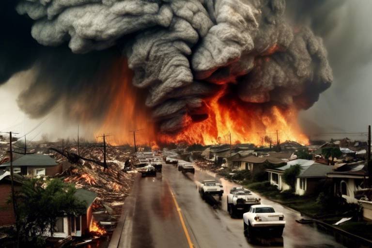
Natural disasters have a way of turning our lives upside down in the blink of an eye. From the raging winds of hurricanes to the sudden tremors of earthquakes, these events can be devastating. But the big question remains: are they predictable? As we delve into this topic, we'll explore the intricate dance between nature and science, examining how advancements in technology and historical data play a crucial role in forecasting these unpredictable events.
In recent years, scientists have made significant strides in understanding the patterns and behaviors of natural disasters. With the help of sophisticated models and analytical techniques, researchers are now better equipped to predict when and where a disaster might strike. Yet, despite these advancements, the nature of these events often leaves us with more questions than answers. It’s like trying to catch smoke with your bare hands—just when you think you’ve got a grip, it slips away. So, let’s take a closer look at how we navigate this complex landscape.
To truly grasp the predictability of natural disasters, we need to understand the science behind it. Meteorologists and geologists utilize a variety of methodologies to analyze historical data, weather patterns, and geological indicators. This is akin to piecing together a jigsaw puzzle, where each piece represents crucial information about past events. By examining these pieces, scientists can make educated guesses about future occurrences. However, the unpredictability of nature often throws a wrench in even the best-laid plans.
One of the most fascinating aspects of disaster prediction is the reliance on historical data. By studying past events, researchers can identify trends and patterns that inform current predictive models. For instance, if a region has experienced multiple hurricanes over the past few decades, it’s reasonable to assume that it might face similar threats in the future. This historical lens not only helps in forecasting but also in preparing communities for potential disasters. Imagine being able to warn a town about an impending flood based on data collected from previous years; it could mean the difference between life and death.
However, predicting natural disasters isn’t just about crunching numbers and analyzing data. There are real-life implications of these predictions. When warnings are accurate, they can save lives and minimize property damage. For example, when meteorologists accurately predict a hurricane's path, communities can evacuate and prepare, reducing the risk of casualties. It’s a race against time, and the stakes couldn’t be higher.
As we explore specific types of natural disasters, it's important to note that the predictability varies greatly. Hurricanes and typhoons, for instance, have become more predictable due to advancements in meteorological tools and models. However, the same cannot be said for earthquakes, which remain one of the most challenging disasters to predict accurately. The complexities involved in seismic activity make it difficult to establish a reliable forecasting method, leading researchers to continue their quest for better solutions.
In conclusion, while we have made significant progress in predicting natural disasters, the journey is far from complete. The unpredictable nature of these events, coupled with the limitations of current methodologies, keeps us on our toes. But with ongoing research and technological innovations, there’s hope on the horizon. As we continue to advance our understanding and capabilities, we inch closer to a future where we can better predict and prepare for the forces of nature.
- Can all natural disasters be predicted? - No, while some disasters like hurricanes can be predicted with reasonable accuracy, others like earthquakes remain challenging to forecast.
- What technologies are used in disaster prediction? - Technologies such as satellite imagery, remote sensing, and machine learning algorithms play a significant role in enhancing prediction accuracy.
- How can historical data improve predictions? - Analyzing historical data allows researchers to identify patterns and trends that inform current predictive models, ultimately improving forecasting efforts.
- What is the role of machine learning in disaster prediction? - Machine learning helps analyze vast datasets to identify patterns and improve the accuracy of predictive models.

The Science of Prediction
Understanding the science of prediction is essential when it comes to natural disasters. It’s like trying to read the mind of Mother Nature—an endeavor filled with challenges and surprises. Scientists employ various methodologies and technologies that help them analyze patterns and forecast potential disasters. By examining atmospheric conditions, geological activity, and historical data, they aim to create models that can predict when and where disasters might strike. But how do they do it?
One of the primary tools in this arsenal is data analysis. Scientists collect vast amounts of data from various sources, including weather stations, satellite imagery, and seismic sensors. This data is then fed into complex algorithms that analyze trends and anomalies. For instance, meteorologists utilize sophisticated models that simulate atmospheric conditions to predict weather-related disasters like hurricanes. These models take into account numerous variables, such as temperature, humidity, and wind patterns, to provide forecasts that can be crucial for early warning systems.
Another key aspect is the use of technology. With advancements in technology, the ability to predict natural disasters has improved significantly over the past few decades. For example, satellite technology allows scientists to monitor weather systems in real-time, providing valuable information that can enhance forecasting accuracy. Additionally, remote sensing techniques have become indispensable in understanding environmental changes that may indicate an impending disaster. By analyzing satellite images, scientists can detect shifts in land use, vegetation health, and even changes in water bodies, all of which can signal potential hazards.
However, the science of prediction is not without its limitations. Despite the advancements, predicting certain types of disasters remains an enigma. For instance, while meteorologists can forecast hurricanes days in advance, predicting earthquakes is still largely uncertain. This is because earthquakes occur suddenly and are often preceded by little to no warning. Scientists are continuously researching to find reliable indicators that could predict seismic activity, but as of now, the ability to forecast earthquakes remains a significant challenge.
In summary, the science of predicting natural disasters is a multifaceted field that combines data analysis, technological innovation, and rigorous research. While we have made great strides in forecasting events like hurricanes and floods, the journey is far from complete. As we continue to harness new technologies and refine our methodologies, the hope is that we can improve our predictive capabilities, ultimately saving lives and minimizing damage when disaster strikes.
- What are the main methods used for predicting natural disasters? The main methods include data analysis, satellite monitoring, and advanced modeling techniques.
- Why is earthquake prediction so challenging? Earthquakes happen suddenly and often show no clear warning signs, making them difficult to predict accurately.
- How has technology improved disaster prediction? Technology has enabled real-time monitoring and analysis of environmental conditions, leading to more accurate forecasts.
- What role does machine learning play in disaster prediction? Machine learning helps analyze vast datasets, enhancing the accuracy of predictive models.

Historical Data Analysis
When it comes to predicting natural disasters, one of the most powerful tools at our disposal is . By examining past events, scientists and meteorologists can uncover patterns and trends that might not be immediately apparent. It's like piecing together a puzzle: each piece of data adds to the overall picture of how disasters unfold over time. For instance, analyzing the frequency, intensity, and geographical distribution of past hurricanes can help forecast future storms with greater accuracy.
Consider this: every natural disaster leaves behind a trail of data—records of wind speeds, rainfall amounts, seismic activity, and more. By compiling and analyzing this information, researchers can develop models that predict how similar events might behave in the future. These models can be incredibly detailed, incorporating various factors such as climate change, population density, and urban development. However, it's essential to recognize that while historical data is invaluable, it is not infallible. The past can inform us, but it cannot guarantee future outcomes.
One fascinating aspect of historical data analysis is its ability to highlight regional variations in disaster patterns. For example, certain areas may experience more frequent flooding due to their geographical features, while others might be more prone to earthquakes. By understanding these regional differences, emergency management teams can tailor their preparedness plans to meet specific needs. For instance, coastal communities might prioritize hurricane preparedness, whereas those in seismically active regions might focus on earthquake drills.
Moreover, historical data analysis isn't just about looking back; it's also about improving our predictive models. By continuously updating these models with new data, scientists can refine their forecasts and enhance their accuracy. This iterative process is crucial, as it allows for the incorporation of new findings and technologies. For example, the National Oceanic and Atmospheric Administration (NOAA) regularly updates its hurricane prediction models, which have become increasingly sophisticated thanks to advancements in technology and data collection.
| Disaster Type | Key Historical Data Points | Predictive Insights |
|---|---|---|
| Hurricanes | Wind speed, storm surge, rainfall | Improved forecasting accuracy through satellite data |
| Earthquakes | Seismic activity, fault lines, historical tremors | Identifying high-risk areas for better preparedness |
| Floods | Rainfall patterns, river levels, land use | Enhanced flood prediction models using climate data |
In conclusion, historical data analysis is a cornerstone of natural disaster prediction. It provides a wealth of information that can be used to forecast future events, improve preparedness, and ultimately save lives. However, it is essential to approach this data with a critical eye, acknowledging its limitations while leveraging its strengths. The interplay between historical trends and modern technology continues to evolve, offering hope for more accurate predictions in the years to come.
- How does historical data improve disaster prediction? Historical data helps identify patterns and trends that inform predictive models, enhancing their accuracy.
- What types of disasters can be predicted using historical data? Various disasters, including hurricanes, earthquakes, and floods, can be analyzed through historical data.
- Are there limitations to using historical data for predictions? Yes, historical data cannot account for unprecedented events or changes in climate, which may affect future disaster patterns.

Case Studies of Successful Predictions
When it comes to predicting natural disasters, there are moments that stand out as shining examples of success. These case studies not only highlight the effectiveness of current methodologies but also underscore the importance of timely warnings in saving lives. For instance, let’s look at Hurricane Katrina in 2005. Meteorologists utilized advanced satellite imagery and computer models to predict the storm's trajectory. Their forecasts allowed for early evacuations, saving countless lives, even though the disaster itself was catastrophic. This is a classic case where the prediction capabilities of meteorologists were put to the test, and while the aftermath was devastating, the warning system played a crucial role in minimizing loss of life.
Another notable example is the 2010 earthquake in Haiti. Although the earthquake struck with little warning, the international community had been alerted to the region's seismic risks due to historical data analysis. Organizations had been monitoring the tectonic activity in the area for years, which led to increased awareness and preparedness efforts. While the prediction of the exact moment of the earthquake was impossible, the groundwork laid by previous studies meant that some buildings were retrofitted, and emergency services were somewhat prepared for the aftermath. This shows how historical data can inform current practices, even when precise predictions are elusive.
Furthermore, let’s not overlook the role of technology in successful predictions. For example, in 2017, Hurricane Harvey's path was accurately predicted several days in advance, allowing residents in Texas to prepare for the unprecedented rainfall and flooding. The use of Doppler radar and advanced meteorological models enabled forecasters to provide timely and accurate information. This case illustrates how technological advancements have vastly improved our ability to predict not just the occurrence of storms but their potential impacts as well.
In summary, these case studies illustrate that while predicting natural disasters is fraught with challenges, there are instances where the combination of scientific methodology, historical data, and cutting-edge technology has led to successful predictions. Each success story serves as a reminder of the importance of continuous research and investment in predictive models. The question remains, however: how can we further enhance these systems to ensure that we are even better prepared for the next inevitable disaster?
- What are the main challenges in predicting natural disasters?
The main challenges include the complexity of natural systems, lack of comprehensive data, and limitations in current technology. - How accurate are current disaster prediction models?
While models have improved significantly, their accuracy can vary based on the type of disaster and available data. - Can technology completely eliminate the risk of natural disasters?
No, while technology can enhance prediction and preparedness, it cannot eliminate the occurrence of natural disasters. - What role does historical data play in disaster prediction?
Historical data helps identify patterns and trends, which can inform current predictive models and improve forecasting accuracy.

Hurricanes and Typhoons
When it comes to predicting hurricanes and typhoons, we enter a realm where science meets nature's fury. These tropical storms are not just meteorological phenomena; they are colossal forces that can wreak havoc on communities, economies, and ecosystems. Understanding how meteorologists predict these storms is essential for preparedness and response. The process involves a combination of advanced technology, historical data, and a deep understanding of atmospheric conditions.
One of the primary tools in forecasting hurricanes is the use of satellite imagery. Satellites orbiting the Earth capture real-time data about cloud formations, wind patterns, and sea surface temperatures. This data is crucial because it allows meteorologists to monitor the development of storms from their inception. For example, when warm, moist air rises over warm ocean waters, it creates an environment ripe for storm formation. Meteorologists analyze these conditions to predict whether a storm will intensify into a hurricane.
Additionally, meteorologists utilize a variety of computer models to simulate and predict the path of hurricanes and typhoons. These models incorporate vast amounts of data from various sources, including ocean buoys, weather stations, and aircraft reconnaissance. By inputting this data into sophisticated algorithms, meteorologists can forecast the storm's trajectory, intensity, and potential landfall. The accuracy of these models has significantly improved over the years, yet there are still challenges. For instance, small changes in atmospheric conditions can lead to vastly different outcomes, making precise predictions difficult.
Moreover, meteorologists rely on a network of buoys and radar systems to gather data on ocean conditions and storm movements. These tools provide invaluable information about wave heights, wind speeds, and atmospheric pressure, which are critical for understanding the storm's behavior. For instance, the National Oceanic and Atmospheric Administration (NOAA) operates a network of buoys in the Atlantic and Pacific Oceans that continuously transmit data to meteorologists. This real-time information is vital for issuing timely warnings to communities in the storm's path.
Despite these advancements, predicting hurricanes and typhoons is not without its challenges. One of the biggest hurdles is the rapid intensification of storms. Hurricanes can quickly escalate from a tropical storm to a Category 5 hurricane in a matter of hours, leaving little time for preparation. This unpredictability can be attributed to various factors, including ocean temperatures, wind shear, and atmospheric pressure. As a result, even with cutting-edge technology, there are instances where predictions fall short, leading to dire consequences.
In conclusion, while meteorologists have made significant strides in predicting hurricanes and typhoons, the nature of these storms remains inherently unpredictable. The combination of advanced technology, historical data, and real-time monitoring has improved forecasting accuracy, but challenges still exist. As we continue to develop new tools and methodologies, the hope is that we can enhance our ability to predict these powerful storms, ultimately saving lives and minimizing damage when disaster strikes.
- How are hurricanes classified? Hurricanes are classified into categories based on their wind speeds, ranging from Category 1 (least severe) to Category 5 (most severe).
- What is the difference between a hurricane and a typhoon? The primary difference is the location; hurricanes occur in the Atlantic and Northeast Pacific, while typhoons occur in the Northwest Pacific.
- Can hurricanes be stopped or redirected? Currently, there is no technology that can stop or redirect hurricanes. The focus remains on prediction and preparedness.
- How can I prepare for a hurricane? It's essential to have an emergency kit, a communication plan, and to stay informed about local evacuation routes and shelters.

Earthquake Prediction Challenges
When it comes to predicting earthquakes, the truth is, it's like trying to read a book that's been written in a secret code. Earthquakes are notoriously unpredictable and can strike with little to no warning, leaving scientists scratching their heads and communities on edge. One of the primary challenges in earthquake prediction is the **complexity of tectonic movements**. The Earth's crust is a jigsaw puzzle of plates that are constantly shifting, colliding, and sometimes slipping past one another. This dynamic nature makes it incredibly difficult to pinpoint when and where an earthquake will occur.
Another significant hurdle is the **lack of historical data** for many regions. While some areas have extensive records of seismic activity, others are less documented. This absence of data can lead to gaps in understanding patterns and trends. For instance, if a region hasn't experienced an earthquake in a long time, it may be easy to assume it’s safe, but that could be misleading. A dormant area can suddenly awaken, catching residents completely off guard.
Moreover, scientists face the challenge of differentiating between **natural seismic noise** and actual earthquake signals. The Earth is constantly in motion, and it produces a variety of vibrations that can mimic the signs of an impending quake. This overlap can lead to false alarms or, worse, missed opportunities to warn communities about a real threat. Imagine a fire alarm that goes off every time someone cooks dinner; eventually, people start ignoring it, which could be catastrophic in the event of a real fire.
To illustrate some of these challenges, consider the following table that summarizes key factors affecting earthquake prediction:
| Challenge | Description |
|---|---|
| Complex Tectonic Movements | The unpredictable nature of plate tectonics makes forecasting difficult. |
| Lack of Historical Data | Insufficient records hinder the understanding of seismic patterns. |
| Natural Seismic Noise | Difficulty distinguishing between harmless vibrations and actual earthquake signals. |
In addition to these factors, there’s also the issue of **public perception and preparedness**. Many people may not take earthquake warnings seriously due to a lack of understanding about the risks involved. This can lead to panic or chaos when an earthquake does occur, as people scramble to react without a clear plan. Therefore, improving education on earthquake readiness and response is crucial.
Lastly, ongoing **research and technological advancements** are essential to overcoming these challenges. Scientists are continually exploring new methods, such as using **machine learning algorithms** to analyze seismic data more effectively. By leveraging these technologies, researchers hope to develop more accurate predictive models that could save lives and minimize damage when the ground begins to shake.
In conclusion, while predicting earthquakes poses significant challenges, the quest to understand and forecast these natural disasters continues. With every advancement in technology and data analysis, we inch closer to cracking the code of earthquake prediction. Until then, staying informed and prepared remains our best defense against the unpredictable nature of seismic events.
- Can earthquakes be predicted accurately? Currently, accurate predictions are challenging due to the complex nature of tectonic movements and lack of data.
- What technologies are being used to predict earthquakes? Researchers are utilizing machine learning, remote sensing, and advanced seismic monitoring systems to improve prediction methods.
- How can communities prepare for earthquakes? Education on earthquake safety, creating emergency plans, and conducting drills can significantly enhance community preparedness.

Limitations of Current Methods
Despite the remarkable advancements in science and technology, predicting natural disasters remains a daunting task. One of the primary limitations is the inherent complexity of natural systems. For instance, while meteorologists can forecast weather patterns with relative accuracy, the chaotic nature of the atmosphere means that minor changes can lead to vastly different outcomes. This unpredictability is akin to trying to predict the exact moment a bubble will burst in a pot of boiling water; it’s just not that straightforward.
Another significant challenge stems from the limited availability of data. Many regions, especially in developing countries, lack comprehensive monitoring systems. This data gap can lead to incomplete models that fail to account for critical local factors. Imagine trying to solve a puzzle with missing pieces; the picture you get is often skewed and incomplete. Without robust data, predictions can be unreliable, leaving communities vulnerable.
Additionally, the time constraints involved in issuing warnings pose a major hurdle. For example, while we can track hurricanes days in advance, earthquakes can occur with little to no warning. The suddenness of such events means that even the best predictive models can fall short. It's like being told there's a surprise party, but the surprise happens before you even get a chance to prepare!
Moreover, the interplay of various environmental factors complicates predictions further. Natural disasters often result from a combination of geological, meteorological, and human factors. For instance, a flood may be influenced not just by rainfall but also by soil saturation, river levels, and urban development. This multifaceted nature means that a single predictive model might not capture all the necessary variables, leading to potential inaccuracies.
Lastly, there is the issue of public perception and response. Even when accurate predictions are made, the effectiveness of these warnings can be undermined by public skepticism or misinformation. If people do not take warnings seriously, the best forecasts in the world won't save lives. It’s crucial to not only improve prediction methods but also to enhance communication strategies to ensure that communities understand and trust the information being provided.
In summary, while advancements in technology and methodology have improved our ability to predict natural disasters, significant limitations still exist. Addressing these challenges requires ongoing research, better data collection, and effective communication strategies to ensure that communities are prepared and informed.
- Can we predict earthquakes? - Currently, predicting earthquakes with precision is not possible. Scientists are working on understanding patterns, but the sudden nature of earthquakes makes them difficult to forecast.
- How accurate are hurricane predictions? - Hurricane predictions have become quite accurate, with advanced models allowing meteorologists to forecast paths and intensities days in advance.
- What role does technology play in disaster prediction? - Technology, such as satellite imagery and machine learning, is crucial in analyzing data and improving the accuracy of predictions.

Technological Innovations
In the ever-evolving landscape of natural disaster prediction, play a pivotal role in enhancing our understanding and forecasting capabilities. As we delve into this realm, it’s fascinating to observe how advancements in technology have transformed the way scientists and meteorologists approach the unpredictability of natural disasters. From satellite imagery to artificial intelligence, these innovations are not just tools; they are lifelines that help us anticipate calamities before they strike.
One of the most significant breakthroughs in disaster prediction is the use of remote sensing technologies. This involves the collection of data from satellites and aerial platforms, which provide critical information about atmospheric conditions, land use, and even ocean temperatures. For instance, satellites equipped with advanced sensors can monitor cloud formations and sea surface temperatures, which are crucial in predicting the development of hurricanes. The data collected is then analyzed to create detailed models that simulate potential disaster scenarios, enabling authorities to issue timely warnings to communities at risk.
Moreover, the integration of machine learning into predictive models has revolutionized our approach to forecasting. By leveraging vast amounts of historical data, machine learning algorithms can identify patterns and correlations that may not be immediately apparent to human analysts. This capability allows for more accurate predictions of when and where disasters might occur. For example, machine learning has been effectively utilized in analyzing seismic data to improve earthquake prediction models, despite the inherent challenges in this field. The ability to process and analyze data at an unprecedented scale means that we can respond more effectively to emerging threats.
To illustrate the impact of these innovations, consider the following table, which highlights some of the key technologies currently used in natural disaster prediction:
| Technology | Application | Impact |
|---|---|---|
| Remote Sensing | Monitoring atmospheric conditions and land changes | Improved accuracy in forecasting hurricanes and floods |
| Machine Learning | Analyzing historical data for predictive modeling | Enhanced prediction accuracy for earthquakes and storms |
| Geographic Information Systems (GIS) | Mapping disaster-prone areas and risk assessment | Better resource allocation and emergency planning |
| Drones | Real-time data collection in disaster zones | Rapid assessment of damage and needs |
As we continue to harness these technological advancements, the future of natural disaster prediction looks promising. However, it is essential to recognize that technology alone cannot eliminate the risks associated with natural disasters. Community preparedness, public education, and effective communication are equally important in ensuring that the information provided by these technologies translates into actionable responses. By combining cutting-edge technology with grassroots efforts, we can significantly improve our resilience to natural disasters.
- How accurate are current disaster prediction technologies? While no system can guarantee 100% accuracy, advancements in technology have significantly improved prediction models, allowing for timely warnings and better preparedness.
- What role does machine learning play in disaster prediction? Machine learning analyzes vast datasets to identify patterns and improve the accuracy of predictive models, enhancing our ability to forecast disasters.
- Can technology prevent natural disasters? Technology cannot prevent disasters, but it can significantly enhance our ability to predict them and mitigate their impact through timely warnings and preparedness strategies.

Remote Sensing Techniques
When we think about predicting natural disasters, one of the most fascinating tools at our disposal is remote sensing. This technology allows scientists to gather data about the Earth's surface without having to be physically present, almost like having a bird's-eye view of the planet. Imagine being able to see the changes in land use, vegetation cover, and even water levels from space! Remote sensing techniques utilize satellites and aerial imagery to collect crucial information that can help forecast disasters such as floods, hurricanes, and wildfires.
One of the key benefits of remote sensing is its ability to monitor large areas quickly and efficiently. For instance, when a hurricane is approaching, meteorologists can use satellite data to track the storm's path and intensity in real-time. This data is invaluable because it enables authorities to issue timely warnings to communities that may be at risk. The technology works by capturing images and data across various wavelengths, which can reveal different characteristics of the Earth's surface. For example, infrared imagery can detect temperature changes, helping to identify areas of flooding or heat anomalies that might indicate a wildfire.
In addition to tracking storms, remote sensing can also analyze historical data to identify patterns that may indicate future disasters. By examining changes over time, scientists can assess the likelihood of events like landslides or droughts. This long-term analysis is crucial for developing predictive models that can inform urban planning and disaster preparedness strategies.
To give you a clearer picture of how remote sensing is applied, here’s a brief overview of its key components:
| Technique | Description | Applications |
|---|---|---|
| Satellite Imagery | Captures images of the Earth's surface from space. | Tracking hurricanes, monitoring deforestation. |
| Radar Systems | Uses radio waves to detect precipitation and storm systems. | Weather forecasting, flood monitoring. |
| LiDAR | Uses laser light to measure distances and create detailed 3D maps. | Assessing land elevation, flood risk analysis. |
Furthermore, remote sensing isn't just limited to meteorology. It's also instrumental in assessing the impact of disasters after they occur. For example, after a flood, satellite imagery can help determine the extent of the damage, allowing for more effective recovery efforts. This rapid assessment capability is essential for allocating resources and coordinating relief efforts efficiently.
As we continue to refine these techniques, the potential for remote sensing to enhance disaster prediction and response becomes even more promising. It's like having a sophisticated set of binoculars that not only help us see what's happening now but also allow us to look back and learn from the past. With ongoing advancements in technology, we can expect even greater accuracy and reliability in predicting natural disasters, ultimately leading to better preparedness and saving more lives.
- What is remote sensing? Remote sensing is the acquisition of information about an object or phenomenon without making physical contact, typically through satellite or aerial imagery.
- How does remote sensing help in disaster prediction? It allows meteorologists and scientists to monitor large areas and gather data on environmental changes, which can indicate potential disasters.
- Can remote sensing predict earthquakes? Currently, remote sensing is not effective for predicting earthquakes, but it can help assess damage after an earthquake occurs.
- What are the limitations of remote sensing? Limitations include the inability to capture real-time data in certain conditions, such as during heavy cloud cover, and challenges in interpreting complex data.

Machine Learning in Prediction
Machine learning is rapidly transforming the landscape of natural disaster prediction, offering unprecedented capabilities that were previously unimaginable. Imagine having a system that can learn from vast amounts of data, identify patterns, and make predictions that can potentially save lives and property. That’s what machine learning brings to the table! By leveraging complex algorithms and computational power, researchers can analyze historical disaster data, real-time environmental conditions, and even social media activity to create more accurate predictive models.
At the heart of this innovation is the ability of machine learning to process and analyze data at a scale and speed that humans simply cannot match. For example, during hurricane season, machine learning algorithms can sift through satellite imagery and weather data to detect changes in storm patterns. This is crucial because even a slight shift in a storm's path can mean the difference between safety and disaster for coastal communities. By recognizing these patterns early, emergency services can issue timely warnings, allowing residents to prepare or evacuate as necessary.
Moreover, machine learning models are not only reactive but also proactive. They can predict the likelihood of a disaster occurring based on various factors, such as geological data for earthquakes or climatic conditions for floods. For instance, researchers have developed models that use historical seismic data combined with real-time geological monitoring to assess the probability of an earthquake in a specific region. While predicting the exact moment of an earthquake remains elusive, these models can provide critical insights into areas at higher risk, enabling better preparedness and risk mitigation strategies.
However, the effectiveness of machine learning in disaster prediction is not without its challenges. Data quality and availability play significant roles; if the data fed into these algorithms is incomplete or biased, the predictions can be misleading. Additionally, machine learning models require continuous training and updating to remain accurate, which means that ongoing research and investment are essential. This is where collaboration among scientists, governments, and technology companies becomes vital. By sharing data and resources, they can improve the algorithms and enhance predictive accuracy.
To illustrate the impact of machine learning in this field, consider the following table that outlines some of the key applications:
| Application | Description | Impact |
|---|---|---|
| Hurricane Tracking | Analyzing satellite images and weather patterns to predict hurricane paths. | Improved evacuation planning and disaster response. |
| Earthquake Risk Assessment | Using seismic data to identify regions at high risk of earthquakes. | Enhanced preparedness and mitigation strategies. |
| Flood Forecasting | Integrating rainfall data and river flow statistics to predict flooding events. | Timely warnings that save lives and reduce property damage. |
In conclusion, machine learning is not just a buzzword; it is a powerful tool that is reshaping how we approach disaster prediction. By harnessing the power of data and advanced algorithms, we can gain deeper insights into natural disasters, improve our response strategies, and ultimately save lives. As technology continues to evolve, the potential for machine learning in this arena will only grow, making it an exciting field to watch in the years to come.
- What is machine learning? Machine learning is a subset of artificial intelligence that enables computers to learn from data and make predictions or decisions without being explicitly programmed.
- How does machine learning improve disaster prediction? By analyzing vast datasets, machine learning algorithms can identify patterns and trends that help predict the likelihood and impact of natural disasters.
- What are the limitations of machine learning in disaster prediction? Data quality, availability, and the need for continuous updating of models can limit the accuracy of predictions.
- Can machine learning predict earthquakes? While it can assess risk based on historical data, predicting the exact timing of an earthquake remains a challenge.
Frequently Asked Questions
- Can natural disasters be predicted accurately?
While advancements in science and technology have improved our ability to predict natural disasters, complete accuracy is still elusive. Factors like the chaotic nature of the atmosphere and geological processes make it challenging to forecast events like earthquakes and hurricanes with pinpoint precision.
- What technologies are used for predicting natural disasters?
Several technologies are employed in disaster prediction, including satellite imagery, remote sensing, and machine learning algorithms. These tools help analyze patterns and data to provide forecasts that can save lives and property.
- How do scientists analyze historical data for predictions?
Scientists study past natural disasters to identify patterns and trends. By examining historical data, they can develop models that inform current predictions, helping to anticipate when and where future disasters may occur.
- What are the biggest challenges in earthquake prediction?
Earthquake prediction is particularly challenging due to the complex nature of tectonic movements and the lack of clear precursors. Unlike hurricanes, which have observable signs, earthquakes can strike suddenly and without warning, making them difficult to forecast accurately.
- How do meteorologists predict hurricanes?
Meteorologists use a combination of satellite data, weather models, and historical patterns to predict hurricanes. They analyze atmospheric conditions and ocean temperatures to forecast the likelihood of storm formation and track its path.
- What role does machine learning play in disaster prediction?
Machine learning enhances disaster prediction by analyzing vast amounts of data more efficiently than traditional methods. It can identify patterns and anomalies in data that may indicate a potential disaster, leading to more accurate forecasts.
- Are there any successful examples of disaster predictions?
Yes, there have been notable instances where predictions were accurate, such as the forecasting of Hurricane Katrina. Timely warnings allowed many people to evacuate, demonstrating the effectiveness of current methodologies in saving lives.
- What limitations do current predictive models face?
Current predictive models face limitations such as data gaps, the unpredictability of natural systems, and the need for continuous refinement. Factors like climate change also complicate predictions, as they can alter historical patterns.

